
Insights Library
Greenfield Development Due Diligence in Victoria: A Comprehensive Legal and Strategic Guide


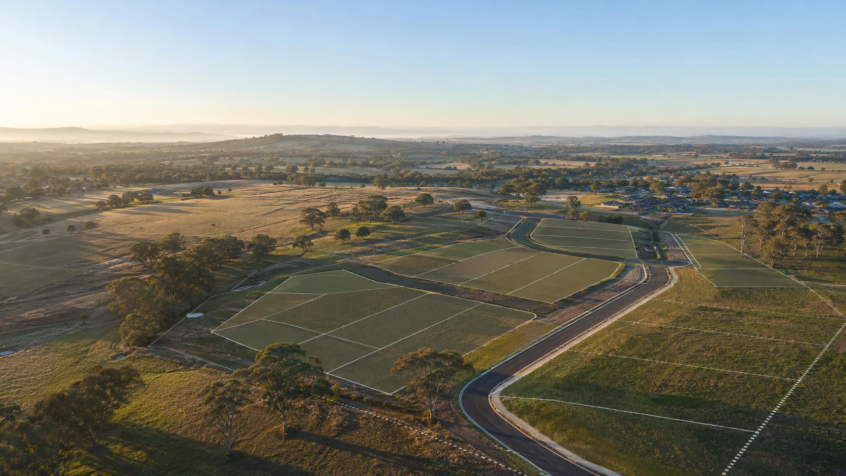

This article is a comprehensive reference guide to the legal, planning, infrastructure, environmental and commercial considerations involved in greenfield site acquisition and development due diligence in Victoria. It is intended for developers, investors, landowners and their advisors who are assessing undeveloped or growth-corridor land sites.
It draws on Best Hooper’s extensive experience advising clients across the full spectrum of Victorian greenfield development, from initial site selection through to project delivery.
1. The Central Question: How Will This Site Be Delivered?
The starting point for any greenfield development assessment is deceptively simple: the question is not whether the land can be acquired, but whether it can deliver the intended development without significant delays or complications and cost blowouts.
A site may be legally available, zoned for development and reasonably priced. Yet it may still be incapable of supporting the anticipated yield, delivering within the contemplated timeframe, or remaining commercially viable once all planning, infrastructure, servicing and environmental constraints are properly accounted for.
This distinction between acquisition and delivery, is the essential insight that drives development due diligence. It is also the critical step that is most often missed by developers who focus their pre-acquisition enquiries narrowly on title, contract terms and planning controls without engaging persons with the necessary expertise.
Two sites of similar size in the same growth corridor can have materially different development value. One may have a clear planning pathway, available sewer capacity, modest infrastructure obligations and few physical constraints. The other may be carved up by a waterway corridor and a drainage reserve, burdened by uncertain servicing, encumbered by section 173 agreements and potential public acquisitions, and exposed to development contributions that strip a large share of the gross area before a single lot is created. None of that is often obvious from the contract materials. It emerges only from coordinated due diligence.
Effective development due diligence is the process of identifying which issues matter, understanding their significance, and determining how they should influence the acquisition decision, price and structure. It is not a box-ticking exercise. It is a structured risk assessment that should begin as early as possible — ideally before heads of agreement are signed.
| THE CENTRAL PRINCIPLE |
| The question is not ‘Can we buy this site?’ It is: ‘Can this land deliver the development we intend, within an acceptable program, on an acceptable cost base, at the anticipated yield?’ |
2. Planning Risk
Planning controls define how land can be used and developed together with obligations that would attach to a permit. However, an understanding of planning controls is only the beginning of planning due diligence, not the end of it. Some times, it can only come down to experience rather than reading what a planning scheme says.
2.1 Zoning and the Urban Growth Boundary
In Victoria, land use and development are regulated under the Planning and Environment Act 1987, Victorian Planning Provisions (VPPs) and other provisions in a Planning Scheme. The first planning enquiry for any greenfield site is whether the land falls within the Urban Growth Boundary (UGB) or other zoning which would allow for the preferred development outcome.
Land inside the UGB that is programmed but not yet ready for urban development is typically zoned Urban Growth Zone (UGZ) without a schedule. The UGZ is a transitional zone until a schedule is incorporated; it permits limited existing uses but anticipates urban development subject to the preparation and approval of a Precinct Structure Plan (PSP).
Once a PSP is incorporated to apply to a parcel of land, a schedule is typically assigned to the UGZ which is specific to that PSP. See discussion below on PSPs.
There is also other large scale parcels of land within the same precinct typically zoned Farming Zone (FZ) or Rural Conservation Zone (RCZ). Development of such land for urban purposes requires a change to the zone, which is a state government decision and is generally unavailable unless identified in state planning policy.
Key planning enquiries at the zoning stage include:
- What is the current zone and what land uses and development does it permit?
- Is the land within the Urban Growth Boundary?
- If zoned Urban Growth Zone, which schedule applies, and what does it require?
- What is the underlying zoning for any land within the Urban Growth Zone?
- Is the land identified for urban development in Plan Melbourne, the relevant Regional Growth Plan or local planning policy?
- If rezoning is required, what is the likely pathway and timeframe?
- Are there any interim uses permitted on the land while planning approvals are pursued?
2.2 Precinct Structure Plans
A Precinct Structure Plan is the primary planning document for greenfield development in Victoria’s growth corridors. PSPs are prepared by the Victorian Planning Authority (VPA) in partnership with the relevant council and are incorporated into the planning scheme through an amendment process.
Where a PSP has already been approved, it will typically specify:
- the land uses and underlying zoning permitted for each parcel;
- the location and dimensions of roads, arterial and collector;
- the location of public open space, drainage reserves, waterway corridors and conservation areas;
- the location of community facilities, schools and town centres;
- net developable area for each precinct;
- required development contributions under an Infrastructure Contributions Plan (ICP);
- the staging and sequencing of development; and
- any Development Plan Overlay requirements.
The most important practical enquiry is the calculation of net developable area — that is, the portion of the site that can actually be subdivided into lots, after all roads, reserves, waterways, drainage and other PSP dedications are deducted.
An approved PSP does not guarantee development yield. A site may appear large on paper but have a significantly smaller net developable area once PSP land dedications, waterway corridors, drainage reserves and buffer requirements are accounted for. In some precincts, net developable area may be as low as 45–55% of gross site area.
Where a PSP has not yet been approved, additional risks arise:
- The timeframe for PSP approval is uncertain and may extend for several years.
- The content of the PSP, including land use allocations, development yield and infrastructure obligations is not yet known.
- Changes in government policy, infrastructure sequencing decisions or authority reviews may affect the PSP outcome.
- The developer may be exposed to holding costs for an extended period without any certainty of development approval.
Where land is subject to a Development Plan Overlay (DPO), a development plan approved by council is required before subdivision or development can proceed. DPOs are commonly used in areas where PSP-level planning has been completed but detailed design approvals are still required.
2.3 Planning Overlays
Overlays are a critical element of planning due diligence. Unlike zones, which operate across entire areas, overlays apply specific requirements or protections to particular land based on its characteristics. Multiple overlays may apply to the same land simultaneously.
Public Acquisition Overlay (PAO)
The Public Acquisition Overlay (PAO) reserves land for future acquisition by a public authority for a public purpose. The reserving authority is identified in the schedule to the overlay.
A PAO has significant implications for development:
- Land subject to a PAO cannot generally be developed for any use inconsistent with the intended public purpose.
- The existence of a PAO may reduce development yield, affect staging and constrain the area available for lots.
- The owner may be entitled to compensation under Part 5 of the Planning and Environment Act 1987 in certain circumstances or, alternatively, compensation was previously paid and therefore impact a
ndfuture claim. - Compensation may be payable under the Land Acquisition and Compensation Act 1986 (LACA) in respect of the land acquired or severed
- The PAO may present a commercial opportunity: understanding the compensation framework and the authority’s acquisition timeline is essential to maximising value.
A Public Acquisition Overlay is not simply a risk to be avoided. In experienced hands, it can be a compensation opportunity. Understanding the acquiring authority’s intentions, the compensation entitlements available and the appropriate valuation methodology can materially improve the commercial outcome for a developer or landowner.
Floodway Overlay and Land Subject to Inundation Overlay (LSIO)
Both overlays identify land subject to flooding, either in the floodway itself or in areas experiencing inundation in a 1% Annual Exceedance Probability (AEP) flood event. In greenfield contexts, these overlays can affect net developable area, drainage design, earthworks requirements and the location of roads and public facilities.
Environmental Significance Overlay (ESO) and Vegetation Protection Overlay (VPO)
These overlays protect areas of environmental or ecological significance. They may require assessments, limit vegetation removal or impose conditions on development. The interface between these overlays and native vegetation requirements under the Flora and Fauna Guarantee Act 1988 and the Environment Protection and Biodiversity Conservation Act 1999 (Cth) must be considered carefully. Even if a site is not apparently affected by any particular vegetation at the time of acquisition, it may be affected by vegetation from adjoining land which may impact development of the site.
Development Plan Overlay (DPO)
A DPO requires an approved development plan before subdivision or development can proceed. The DPO typically specifies the matters that must be addressed in the development plan, including layout, drainage, access, staging and landscaping. Approval of a development plan is a council decision and may be subject to referral to other authorities.
A an approved development plan may not always be readily available and, in some instances, a plan may be site-specific which may impact the site under review.
Heritage Overlay
A Heritage Overlay identifies places of cultural heritage significance. It may restrict works to, and in the vicinity of, heritage places. In growth areas, heritage overlays typically apply to historic homesteads, trees or archaeological sites.
Other Overlays
Depending on the location of a site, other overlays may also apply, including the Salinity Management Overlay, Bushfire Management Overlay, Significant Landscape Overlay and various Special Use Zone provisions. A comprehensive overlay search should be undertaken as part of due diligence, and each applicable overlay assessed for its impact on development potential.
A Development Contributions Plan Overlay or Infrastructure Contributions Plan Overlay may also apply (refer below).
2.4 Development Contributions Plans and Infrastructure Contributions Plans
Development contributions are a significant cost of greenfield development and must be fully assessed as part of due diligence. The levies that may apply also differ between plans. In Victoria, there are several contribution mechanisms that may apply simultaneously.
Infrastructure Contributions Plans (ICPs)
An ICP is a statutory mechanism under the Planning and Environment Act 1987 that requires developers to contribute to the cost of infrastructure in the precinct, including roads, drainage, community facilities and public open space. ICPs are incorporated into the planning scheme and apply to all development in the relevant area.
Contributions under an ICP may take the form of monetary contributions, land contributions or works in kind. Understanding the ICP structure requires more than simply identifying the levy rate and potential credits or reimbursements.
- Inner Public Purpose Land (IPPL) refers to land identified in the ICP as being required for a public purpose (ie roads, drainage, open space or community facilities) that falls within the precinct. IPPL must typically be provided to the collecting agency (usually the council) and may or may not attract compensation or a credit against contributions through a land in kind agreement.
- Outer Public Purpose Land (OPPL) refers to land required for public purposes that falls outside the PSP precinct. OPPL is less common but can arise where regional infrastructure requirements affect land in or near the growth precinct.
- The correct classification of land within a site as IPPL or OPPL has significant implications for net developable area calculations, contribution liability and the overall feasibility of the project.
Works in kind (WIK) and land in kind (LIK) arrangements can be commercially significant. A developer who delivers ICP infrastructure (such as a road or drainage reserve) may receive a credit against the ICP contribution otherwise payable. Negotiating WIK and LIK arrangements requires specialist legal advice and must be formalised in an agreement in accordance with the requirements of any planning permit and infrastructure plan.
In relation to any land credit, there is only a limited ability to challenge the value ascribed to a parcel of land; get in early or risk missing out.
One must also consider the risks which will arise in relation to how Council may seek to limit credits for the project available to the owner and cashflow timing for excess credits.
Developers should also review whether any construction projects identified in the ICP affect the subject land. For example, whether a road, open space or drainage project is programmed to run through or adjacent to the site, and whether that has implications for staging, access or lot layout. These may also be imposed through works in kind agreements.
Growth Areas Infrastructure Contribution (GAIC)
The Growth Areas Infrastructure Contribution (GAIC) is a state government levy that applies to land in the designated growth areas when rezoned, subdivided or used for certain purposes. The GAIC rate is indexed annually.
Key GAIC issues include:
- Determining whether the GAIC applies to the relevant land.
- Calculating the current GAIC liability and sensitivity-testing against future rate increases.
- Identifying whether any GAIC exemptions are available.
- Understanding the timing of GAIC payment relative to the development program including staging arrangements.
- Assessing whether a works in kind arrangement may be available to offset the GAIC.
- Ensuring that no pre-development works trigger a GAIC event which may then trigger a payment requirement.
Melbourne Strategic Assessment (MSA) Levies
The Melbourne Strategic Assessment (MSA) is a program approved under the Environment Protection and Biodiversity Conservation Act 1999 (Cth) that provides for the offset of impacts on nationally significant biodiversity in Melbourne’s growth areas. Development in most growth areas is subject to MSA levies or biodiversity offset requirements. Developers should confirm the current levy rate, any on-site habitat obligations and the mechanism for discharging the MSA obligation.
Where land is not within a levy area, the ability to clear any biodiversity should be seriously considered.
This levy replaces the former habitat compensation.
2.5 Permit Conditions and Post-Approval Obligations
Even where a planning permit has been issued, development cannot always proceed immediately or in the manner originally contemplated. Permit conditions commonly impose obligations that may require works before subdivision, impose staging or sequencing requirements, require execution of a section 173 agreement, require delivery of infrastructure or facilities, restrict access or layout, or impose financial obligations such as bonds or contributions. We often find post-permit approvals being complex and may impact the feasibility of a development.
A planning permit is not the end of the planning process. It is the beginning of the delivery process. The obligations it imposes, and the timeframe within which they must be met, can be just as important as the permissions it grants.
3. Infrastructure Risk
Infrastructure risk is consistently one of the most significant and underestimated areas of development due diligence. The availability of infrastructure, and the obligations that attach to its delivery, can fundamentally affect development viability, staging and program.
While the availability and cost of delivery for infrastructure is important, so too would be requirements of other parcels within proximity.
3.1 Water and Sewerage
In Victoria, reticulated water and sewerage services in growth areas are generally provided by licensed water authorities: most commonly South East Water, Melbourne Water, Western Water, City West Water or Yarra Valley Water, depending on the precinct location.
Water Supply
Water supply enquiries should address whether reticulated water is available to the site, the relevant pressure zone and whether servicing is possible without augmentation, the augmentation works required and the responsibility for funding them, the developer’s obligations under the Water Act 1989 and the relevant authority’s developer contributions framework, whether a Developer Agreement has been or needs to be entered with the relevant authority, and any timing conditions or sequencing requirements imposed by the authority.
Sewerage
Sewerage servicing is frequently the critical infrastructure constraint for greenfield development. Key enquiries include:
- Whether reticulated sewer is available or whether the site is reliant on a future scheme main.
- The nature of any scheme mains required, the responsible authority, the estimated cost, the funding mechanism and the delivery program.
- Whether the development can be staged to allow early lots to be serviced ahead of full infrastructure delivery.
- Whether temporary servicing solutions (including induction) are available and permissible.
- The relevant authority’s policy on developer-funded augmentation and reimbursement arrangements.
- The full scope of authority requirements and the extent to which cost risk is being allocated to the developer.
We regularly see significant delays in greenfield projects arising from sewer scheme asset delivery. Where Melbourne Water or a relevant authority is responsible for scheme infrastructure, delays in procurement, funding approvals or construction can directly affect a developer’s program. Where an authority seeks to excuse itself of delivery obligations or pushes responsibility onto the developer, specialist legal advice is required urgently.
3.2 Drainage
Drainage infrastructure in growth areas involves the interaction of local, precinct-level and regional drainage systems. The relevant authority for drainage in Melbourne’s growth areas is generally Melbourne Water, with local drainage managed by councils.
Key drainage enquiries include:
- Timing and delivery of any drainage scheme.
- Whether a stormwater management strategy has been approved for the precinct.
- The location and size of any drainage reserves or retarding basins required by the PSP.
- Whether the site drains naturally to an available outfall, or whether pumping or other infrastructure is required.
- The location of any waterways, floodways or overland flow paths affecting the site.
- Whether there are known natural watercourses or easements affecting the drainage strategy.
- The obligations under Melbourne Water’s development services scheme.
- The developer’s obligations regarding stormwater quality treatment (including WSUD requirements).
- The impact of drainage constraints on net developable area.
- Temporary drainage solutions (including basins and water treatment) are available and permissible.
- Impact of drainage required onto or from adjoining sites.
3.3 Roads and Transport
Road infrastructure obligations in growth areas derive from a combination of ICP requirements, planning permit conditions, referral authority conditions and direct negotiation with councils and the Department of Transport and Planning (DTP).
Key road and transport enquiries include:
- Whether the site has legal access from an existing public road.
- The nature and extent of road upgrades or intersection works required as a condition of development.
- Whether any road widening reservations affect the site.
- The developer’s obligations under the relevant ICP in respect of roads.
- Whether any state-funded or authority-funded road upgrades are proposed in proximity to the site, and the timing of those works.
- The interface between the developer’s road obligations and the obligations of adjoining landowners.
- Any public transport obligations, including bus stop or interchange requirements.
- The status of any agreements with DTP or council regarding intersection upgrades.
Paper Roads
A particularly underappreciated risk in greenfield due diligence is the existence of paper roads,; that is, road dedications that appear on title plans or historical survey diagrams but that have never been constructed and may or may not have been formally recorded as public roads.
Paper roads can affect development in several ways:
- A paper road running through or alongside a development site may constrain lot layout if it attains the status of a public road that cannot be developed without a road closure.
- Even if the road is to be discontinued, this may result in significant delays and additional costs.
- The existence of a paper road may create access obligations or rights in favour of adjoining landowners.
- A paper road closure application to council may be required and is not guaranteed to succeed.
- Where a paper road is not a formally dedicated road, its status should be confirmed through survey and title enquiries before any reliance is placed on the area for development purposes.
Road infrastructure obligations are frequently the subject of disagreement between developers and authorities, particularly where the required works are regional in nature but the cost is being sheeted to a single landowner. Understanding the ICP contribution framework and the scope of any permit conditions is essential before accepting obligations that may not be legally enforceable or that duplicate contribution payments already required.
3.4 Electricity and Telecommunications
Electricity supply in growth areas is provided through the distribution network. Augmentation of the distribution network may be required to support a large development. Enquiries should address whether the existing network has capacity to support the proposed development, the augmentation works required and who bears the cost, whether high voltage transmission lines or easements run over or near the site and what development restrictions apply, the timeline for network augmentation and its interface with the development program, and NBN connection obligations.
Given the ability for suppliers to install low-impact facilities, in some circumatnces, without establishing proprietary rights, this infrastructure can sometimes be undetected.
3.5 Adjoining Owners and Shared Infrastructure
Greenfield development rarely occurs in isolation. A developer’s ability to deliver infrastructure on program and within budget often depends on the actions and obligations of adjoining landowners. This is an area of due diligence that is frequently overlooked.
Key considerations relating to adjoining owners include:
- Whether any infrastructure required for the development (roads, drainage, sewer, water) must be delivered in conjunction with or through land owned by an adjoining developer.
- Whether the development is dependent on works being completed on adjoining land as a precondition to authority approvals.
- Whether there are opportunities to share infrastructure delivery costs with adjoining developers (for example, through a shared road, drainage or other infrastructure project) and whether any such arrangements need to be formalised by agreement.
- Whether the adjoining owner has conflicting interests or different staging plans that may affect the timing of shared infrastructure which in turn affects the timing for delivering the development.
- Whether any section 173 agreements or ICP agreements affecting adjoining land impose obligations that interact with the subject site’s development program.
Where shared infrastructure delivery is contemplated, the commercial and legal arrangements between landowners must be formalised before development commences. The absence of a binding agreement on cost allocation, sequencing and dispute resolution can create significant delivery risk for all parties.
Alternatively, advice should be sought on delivery obligations for the site under due diligence and other risks that may arise.
4. Land and Title Risk
Title investigations are a cornerstone of any property acquisition due diligence. In the greenfield context, however, title review must go beyond a simple confirmation of ownership and encumbrances. The question is not only what title issues exist, but also is how those issues affect the intended development outcome.
Surveying advice should also be obtained to verify that physical boundaries, fences and structures are consistent with the registered title and survey plan.
We often find that surveys are left too late in the development process (in some cases post- acquisition), which means that the area of the land and boundaries are misunderstood in preparation of feasibilities. This can some times have serious impacts.
We have, for example, found sites being occupied within Crown land boundaries.
4.1 Title Searches and Ownership
A current title search from the Land Registry confirms the registered proprietor and identifies registered interests. While this will show registered encumbrances, there may be unregistered interests or risks which need to be understood.
Where the land is held in a trust or corporate structure, the acquisition may require investigation of the trust deed, any corporate restrictions on dealing, and any pre-emptive rights or board approvals required. In some cases, land may be held by foreign controlled entities and may require an additional level of scrutiny and may impact the acquisition process.
4.2 Easements (Registered and Unregistered)
Easements are rights allowing one party to use another’s land for a specific purpose. In greenfield development, easements are common and may affect development layout, lot yield, road design and infrastructure corridors. It should not be assumed that these can be dealt with or dispensed in the ordinary course.
A critical aspect of easement due diligence in greenfield contexts is that not all relevant easements are registered on title. Due diligence should identify:
- All registered easements appearing on the title search and plan of subdivision.
- Unregistered easements that may have arisen by undocumented agreement, long use, prescription or implication.
- Infrastructure that has been installed on the land by authorities or service providers without a formal registered easement, such as water mains, sewer lines, drains or electricity cables that cross the site without any registered protection.
- The potential for relocation of existing easements where they conflict with the proposed development layout, and the authority or party whose consent would be required.
- Permission from water authorities in and around easements and infrastructure.
Types of Easement
Easements commonly encountered in greenfield due diligence include:
- Drainage easements; protecting stormwater and sewerage infrastructure corridors.
- Carriageway easements (rights of way); allowing pedestrian or vehicle access across land.
- Service easements; protecting gas, electricity, water or telecommunications infrastructure.
- High voltage power line easements; imposing significant setback restrictions on either side of transmission lines.
- Pipeline easements; imposing setback requirements from gas or liquid fuel pipelines.
Each easement must be read in full. The width, location, permitted uses and enforcement rights vary significantly. An easement that appears incidental on a plan may run through the centre of a proposed development area and fundamentally affect the lot layout.
Often one must look beyond the registered plan of subdivision to identify a Memorandum of Common Provision (MCP) or otherwise which records the terms of easement.
Adverse Possession Risk
Where fences or structures on the subject land or adjoining land have been in place for an extended period, adverse possession risk should be assessed. Under section 8 of the Limitation of Actions Act 1958, a person in adverse possession of land may acquire title after 15 years of exclusive, uninterrupted possession (subject to indefeasibility provisions under the Transfer of Land Act 1958). Section 18 of the Limitation of Actions Act 1958 also provides that where rights have accrued, title to such land has been extinguished.
Adverse possession risk is most commonly encountered in older rural properties or where boundary fences deviate significantly from surveyed boundaries. Best Hooper has particular expertise in adverse possession matters (see our dedicated guide to adverse possession in Victoria).
4.3 Restrictive Covenants
A restrictive covenant is a registered encumbrance that restricts the use or development of land for the benefit of other land. Restrictive covenants in growth areas commonly restrict density, prohibit certain land uses, require building materials or restrict subdivision.
The modification or removal of a restrictive covenant requires an application to the Supreme Court of Victoria under section 84 of the Property Law Act 1958. The applicant must establish that the covenant is obsolete, that modification or removal would not substantially injure the beneficiaries, or that the public interest justifies modification. This is a contested process and not always successful. Developers should identify all restrictive covenants early and take advice on enforceability and removal prospects before proceeding with acquisition.
It is inherently very difficult to remove a registered covenant. In our experience, the process is significantly easier where the developer can obtain consent from the beneficiaries to remove the covenant. This will involve a careful analysis of all the titles affected by the covenant and engaging in negotiations with the beneficiaries.
4.4 Section 173 Agreements
A section 173 agreement is a statutory agreement under the Planning and Environment Act 1987 between the landowner, a responsible authority and, some times, other authorities or persons, registered on title and binding on all subsequent owners.
In greenfield development, section 173 agreements are commonly used to restrict use or development pending PSP approval, require contributions or infrastructure delivery, restrict vegetation clearing or earthworks, or secure commitments given during the planning permit or other development process.
A section 173 agreement must be read carefully to understand what obligations it imposes, whether those obligations are consistent with the intended development, whether any obligations have already been discharged, whether the agreement can be amended or removed by agreement with the responsible authority, and the enforcement consequences of breach.
Developers should also identify whether any new section 173 agreements will be required as conditions of planning approval for the proposed development, and model the program and cost implications of those agreements before acquisition.
In some instances, a section 173 agreement, while obsolete, may restrict development or subsequent sale of the land.
A developer must be aware of mechanisms available to amend or end a section 173 agreement.
See our separate article relating to mechanisms in Section 173 Agreements for greenfield sites.
A section 173 agreement that was appropriate at the time it was entered may have become obsolete or inconsistent with a subsequently approved PSP. However, it remains legally binding unless formally amended or removed. Identifying and addressing legacy section 173 agreements early in the due diligence process avoids significant delivery complications later.
4.5 Waterways, Road Status and Land Assembly
Waterways and Crown Land
Waterways in Victoria are generally Crown land vested in Melbourne Water (for declared waterways) or in the relevant council or catchment management authority. The presence of a waterway on or near a development site has implications for development setback requirements, the extent of any waterway corridor identified in the PSP, access and maintenance obligations and the potential for re-alignment, subject to authority approvals.
Some times waterways are difficult to identify and require specialist advice.
Road Status and Paper Roads
The status of roads abutting or running through a development site must be confirmed. Land that appears to be a road may be a declared public road under the Road Management Act 2004, an unconstructed road reservation (a paper road), a private road, Crown land, or land that was never formally dedicated as a road despite historical use as one.
Paper roads (also discussed above) are a particular risk in growth area sites with long rural histories. Where a paper road exists on or adjacent to a development site, enquiries should confirm whether it has been formally dedicated as a public road, whether a road closure application is available and likely to succeed, and whether its presence affects the development layout or lot access strategy.
Land Assembly Risk
Many greenfield development sites are assembled from multiple parcels or depend on access arrangements, infrastructure rights or development sequencing that involves adjoining landowners. Key assembly risks include revenge strips, adjoining land dependencies, access disputes and infrastructure easement requirements. In competitive growth area acquisitions, it is not uncommon for a key parcel to be held by a party who is aware of their ability to negotiate a premium price. Identifying and addressing these dependencies before acquiring the primary parcel is essential.
5. Environmental Risk
Greenfield land is rarely environmentally unconstrained. Environmental assessments are a standard part of development due diligence and their findings can significantly affect development yield, approval timelines and construction costs.
5.1 Native Vegetation
The removal or disturbance of native vegetation in Victoria is regulated under the Planning and Environment Act 1987 and Clause 52.17 of the Victorian Planning Provisions, the Flora and Fauna Guarantee Act 1988 (Vic) and the Environment Protection and Biodiversity Conservation Act 1999 (Cth), where matters of national environmental significance are engaged.
The Native Vegetation framework under Clause 52.17 requires developers to apply the three-step approach: avoid impacts, minimise impacts, and then offset any unavoidable impacts. Offsets must be provided in accordance with the relevant offset strategy.
The Melbourne Strategic Assessment (MSA) program provides an approved mechanism for managing biodiversity offset requirements in Melbourne’s growth areas. Developers should confirm the feasibility and permissibility of vegetation removal in the context of the proposed development, identify offset requirements, map vegetation location relative to proposed lot layout and infrastructure, and estimate the clearing program and its cost implications.
5.2 Cultural Heritage
The Aboriginal Heritage Act 2006 (Vic) establishes a framework for the protection and management of Aboriginal cultural heritage in Victoria. Where an activity is a high impact activity and is proposed in an area of cultural heritage sensitivity, a Cultural Heritage Management Plan (CHMP) is required. A CHMP is prepared in consultation with the Registered Aboriginal Party (RAP) and must be approved before ground-disturbing works can commence.
CHMP preparation and approval can take 6–18 months or more, depending on the complexity of the site and the responsiveness of the relevant RAP. It can also result in significant costs to the developer. This timeline must be factored into the development program from the outset.
Advice should also be sought about strategies on managing Aboriginal cultural heritage risks.
Best Hooper’s Planning team are very experienced dealing with all aspects of Aboriginal cultural heritage issues including negotiating or administering a CHMP.
5.3 Contamination
In Victoria, the management of contaminated land is regulated under the Environment Protection Act 2017 and associated EPA Victoria guidelines. For greenfield sites, the contamination risk depends significantly on historical land use. A standard contamination assessment involves a Phase 1 Environmental Site Assessment (desktop review), a Phase 2 ESA (site investigation and laboratory analysis) if required, and a Remedial Action Plan. Where contamination is identified, the developer must understand the extent, remediation strategy and cost, the staging implications and any post-remediation management obligations. Contamination issues are often overlooked in greenfield site acquisitions, particularly where sites are being bought with the intention of on-selling without development. Often, the oversight will impact of the price that can be sought for such sites given the cost to remediate will be borne by the eventual purchaser or developer.
5.4 Flood, Drainage and Geotechnical Considerations
Flood risk assessment is an integral part of greenfield due diligence. Melbourne Water and catchment management authorities maintain flood mapping data identifying land subject to inundation in a 1% AEP (100-year) flood event. Flood-affected land may be subject to planning overlays, require earthworks or filling, require a detailed flood study as a condition of approval, and affect the extent of developable land and the design of drainage infrastructure.
Geotechnical conditions on greenfield sites vary significantly and can have a material impact on construction costs and feasibility. Common issues in Melbourne’s growth corridors include highly reactive clay soils, soft or compressible soils requiring ground improvement, fill material from historical earthworks, rock at shallow depth, and high groundwater tables. A preliminary geotechnical assessment should be commissioned during due diligence to identify material risks and their cost implications.
6. Commercial and Financial Risk
Commercial and financial risk assessment is the synthesis of all due diligence findings. It requires an assessment of whether the development can be delivered at a cost structure that supports the feasibility assumptions underpinning the acquisition price.
6.1 Development Contributions and Taxation
The total contribution and taxation liability for a greenfield site must be calculated comprehensively, because individual mechanisms are additive and the cumulative obligation can be substantial.
The Vast Range of Levies
In a typical Melbourne growth area greenfield development, contributions may include ICP or DCP levies (per net developable hectare or per lot, covering roads, drainage, open space and community facilities), the Growth Areas Infrastructure Contribution (GAIC), the Melbourne Strategic Assessment (MSA) levy, council developer contributions, water authority developer contributions, and DTP contributions for arterial road upgrades. Works in kind and land in kind arrangements may be available and should be assessed.
Development contributions are not always final at the time of acquisition. ICP rates are indexed, GAIC rates are reviewed annually, and new contribution obligations may be imposed through planning permits. The contribution liability must be assessed at the time of acquisition and sensitivity-tested against potential rate increases over the development program.
Public Open Space Contributions
Public open space contributions arise either through the relevant planning scheme or at the request of Council under section 18 of the Subdivision Act 1988.
Where the contribution is imposed under the planning scheme, it is a mandatory obligation at a fixed rate for the provision of open space or cash payment in lieu. While the amount requested by Council is capped at 5% (unless otherwise agreed), it may nonetheless remain open to scrutiny where unreasonable.
Valuations assessed for public open space contributions are open to challenge, however rarely understood by developers and councils.
A site under due diligence should be assessed in relation to any exemptions or payment strategies that may be available. A contribution is only payable once in relation to land except in limited circumstances.
Windfall Gains Tax
The Windfall Gains Tax (WGT) is a Victorian state government tax that applies to land rezoned on or after 1 July 2023 where the rezoning results in a capital gain in the value of the land. The WGT is levied on the increase in value of land attributable to rezoning (the ‘windfall gain’) at a rate of:
- 0% where the windfall gain is less than $100,000;
- 62.5% of the windfall gain between $100,000 and $500,000 (with an effective marginal rate tapering); and
- 50% of the windfall gain above $500,000.
The WGT applies at the time of rezoning and is assessed by the State Revenue Office. Importantly, where land is rezoned as part of a PSP process — which is the typical pathway for greenfield growth area land — the WGT may apply on the rezoning event, not on the subsequent sale or development.
Key WGT issues for developers include:
- Whether the relevant land is subject to the WGT on rezoning.
- Whether any exemptions apply.
- The mechanism by which WGT liability is assessed and paid.
- Whether the WGT liability has been or will be passed on to the purchaser through the acquisition price.
- The impact of WGT on the overall feasibility, particularly where land is acquired before rezoning and the WGT crystallises on a subsequent rezoning event.
- Payment deferral options.
- Strategies for minimising or staged payment of any liability.
The WGT is a significant and relatively new cost of greenfield land acquisition in Victoria. It must be factored into feasibility modelling from the outset.
Vacant Residential Land Tax
The Vacant Residential Land Tax (VRLT) is a Victorian land tax that applies to residential land left vacant for more than six months in a calendar year. From 1 January 2025, the VRLT has been extended to apply to residential land in certain regional areas of Victoria in addition to metropolitan Melbourne.
In the greenfield context, the VRLT can apply where:
- a developer holds residential land (or land capable of residential use) that is not being actively developed or occupied;
- the land is not subject to a qualifying exemption (for example, where active development is underway); or
- land that has been rezoned for residential use is held without development activity.
The VRLT rate is 1% of the capital improved value of the land per year. Developers holding greenfield sites should understand the VRLT status of the land and ensure that active development activities are documented to support any exemption claim. Holding cost modelling should include VRLT as a potential liability where applicable.
The “land under development” exemption promised by the government may not always apply.
Land Tax and Holding Costs
Greenfield land held pending development is generally subject to standard land tax under the Land Tax Act 2005. Land tax is assessed on the site value of taxable land held as at 31 December each year and represents a material holding cost over extended development programs. Land tax exemptions may apply where land is used for primary production, but this exemption may not be available once land has been rezoned or where the primary production use has ceased.
Primary production exemptions are becoming more difficult to achieve, particularly within Metro Melbourne. This is due to the requirement for the landowner to be the active primary producer.
In some instances, there may be grounds for landowners to challenge valuations or reassessments of sites that have not yet started development. Best Hooper has successfully acted for developers to achieve that outcome.
GST and the Margin Scheme
Another area often overlooked in the greenfield site acquisitions is how GST is to be treated.
In most cases, where greenfield sites are acquired from individual landowners, and where the landowners are not registered for GST, GST will not be payable on the acquisition of the site.
However, a comprehensive due diligence exercise may reveal that the developer may also be eligible to use the margin scheme as part of its development strategy, which may increase the expected yield. If the margin scheme is available, it is especially critical that the purchase contract is structured accurately so as not to disentitle the developer from using the margin scheme.
Generally, the margin scheme is a way of calculating GST when a developer sells the developed greenfield site as part of its development. When the developer is eligible to use the margin scheme, it will pay GST at the rate of 7% instead of the usual 10%.
6.2 Compulsory Acquisition and Compensation
Where land on or near the development site is subject to compulsory acquisition by a public authority, specialist advice is essential. Compulsory acquisition in Victoria is governed by the Land Acquisition and Compensation Act 1986 (LACA) and the Planning and Environment Act 1987.
The Acquisition Process
Compulsory acquisition in Victoria follows a prescribed process: the acquiring authority issues a Notice of Intention to Acquire (NOITA), the owner has a right to object to the acquisition, and if the acquisition proceeds, the acquiring authority issues a Notice of Acquisition (NOA), vesting title in the authority. Compensation is then assessed and paid.
Compensation Entitlements
Under the LACA, compensation must include the following heads for consideration:
- the market value of the land acquired;
- any loss attributable to severance; reduction in value of the remaining land caused by the acquisition;
- disturbance losses; costs incurred by the owner as a result of the acquisition;
- special value of the land; and
- solatium; a statutory allowance for non-financial disadvantage.
The most common error in compulsory acquisition compensation is undervaluing the land taken, failing to claim severance and injurious affection properly, and failing to claim the full range of disturbance entitlements. Landowners should never accept an authority’s initial offer without independent legal and valuation advice.
Prior Compensation Claims
An important but frequently overlooked aspect of acquisition due diligence is identifying whether any compensation claims have already been made and paid to a previous owner of the land, for example under Part 5 of the Planning and Environment Act 1987. This is relevant because:
- Where a previous owner has already received compensation for the impact of a reservation or infrastructure project on the land, the current owner’s ability to make further compensation claims may be affected.
- Where a previous owner made claims relating to the same public purpose or overlay, the current owner should understand what was claimed, what was paid, and whether that affects the compensation entitlements now available.
- In some cases, prior compensation arrangements may be registered on or noted in relation to the title and should be identified in any title search or authority enquiry.
A search of authority records and enquiry of the relevant acquiring authority should be undertaken to identify any prior compensation history before acquisition.
Compensation for a Planning Blight (Pt 5 Claims)
Where land is subject to a Public Acquisition Overlay, the landowner may in certain circumstances require the acquiring authority to acquire the land under Part 5 of the Planning and Environment Act 1987. This is a valuable right where the PAO is preventing development or causing financial hardship. The exercise of this right requires careful legal advice and strategic timing particularly with reference to the knowledge or assumed knowledge of the blight at the time of purchaser.
6.3 Acquisition Structure and Contract Terms
The structure of the acquisition and the terms of the contract of sale are as important as the due diligence findings themselves. The right contract structure can manage risk, preserve optionality and protect the developer’s commercial position.
Matters to consider include:
- Whether the acquisition should be structured as a direct purchase, an option, a conditional contract or a staged settlement.
- Whether due diligence conditions should be included and, if so, what they should cover.
- Whether access is required by the developer prior to settlement, for example, to carry out due diligence investigations, surveys or testing.
- Whether the developer wants the ability to commence planning applications before settlement, and in some cases, be allowed to start pre-development works.
- The allocation of risk for planning outcomes ie who bears the risk if the PSP does not provide the anticipated yield?
- The treatment of GAIC which is triggered on a dutiable transaction or may already be triggered at the time of purchaser
- Stamp duty implications of the proposed acquisition structure.
- The treatment of GST and how they affect the purchase price.
- The treatment of existing tenancies, licences or occupations on the land.
- Special conditions addressing the key risks identified in due diligence.
In some instances, acquisition of the site may not be the best commercial outcome for the developer, but instead a joint venture or development agreement entered into with the landowner where the developer and landowner agree on the allocation of profits from the development.
6.4 Holding Costs and Program Sensitivity
Holding costs are a material and often underestimated component of greenfield development economics. A site that requires 18–24 months of pre-construction work will accumulate significant costs that must be factored into feasibility. Sensitivity analysis should address:
- The estimated program from acquisition to settlement of the first subdivided lot, including contingency.
- The impact of a 12-month delay in PSP approval, permit or infrastructure delivery on the feasibility.
- Land tax, VRLT (where applicable), rates, interest or opportunity cost of capital over the program.
- The cost of maintaining the land during the holding period.
- The sensitivity of the feasibility to changes in GAIC, ICP, WGT and MSA contribution and tax rates over the program.
6.4 Lease and Other Occupational Rights
A lease typically runs with land, meaning that it would continue to bind incoming owners unless dealt with otherwise. It is important for any purchaser due diligence to include a thorough review of any lease(s) applying to the land to understand how it might impact rights and obligations of the developer. It may also be a useful exercise to make own enquiries for any lease that may apply to the land, including by visual inspection for any occupants; as non-disclosure by the vendor may not absolve any liability of the purchaser following settlement.
A purchaser should also be aware of other occupational rights that may apply to the land, such as licenses or authority access under statutory notices.
7. Pulling It Together: Development Due Diligence as a Strategic Exercise
The purpose of development due diligence is not to produce a report that lists every conceivable risk. The purpose is to produce a clear-eyed assessment of whether the site can deliver the intended development, what risks are material to that outcome, and how those risks should inform the acquisition decision, price and structure.
The most valuable due diligence outcomes are those that result in a revised strategy — not necessarily a decision not to proceed, but a more accurate assessment of what the project will cost, how long it will take, and what contractual protections are necessary to manage the risks identified.
In our experience, the developers who consistently make good acquisition decisions share several characteristics:
- They commission due diligence early, being before completing negotiations on price, and before heads of agreement are signed.
- They use advisors who understand development, not just a lawyer who can review a contract, but advisors with practical experience in how planning, infrastructure, environmental and commercial issues interact in the Victorian growth area context.
- They treat due diligence findings as an input to commercial decision-making, not as a binary pass/fail gate.
- They understand that the greatest value is often found not in identifying a risk but in understanding whether it can be managed, and what managing it will cost.
A development site with a manageable constraint is often more valuable than a site with no obvious constraints. If the constraint is properly understood, properly priced and properly managed. The developers who are consistently ahead of the market are those who can make that assessment accurately, before they commit capital.
Best Hooper’s Property Team is built around this philosophy. We bring together expertise in acquisitions, planning, compulsory acquisition and compensation, land transactions, infrastructure, development and commercial strategy to deliver a coordinated assessment of greenfield sites in Victoria.
We work alongside developers, investors and their technical advisors from initial site identification through to project delivery. We help identify risks based on our experience to help our clients make better decisions about the sites they acquire and the projects they deliver.
| OUR COMMITMENT |
| Best Hooper’s strategic involvement and experience across Victoria’s greenfield precincts means we understand not just what the law says, but how authorities act, how risks interact, and how a well-structured acquisition and delivery strategy can significantly improve the commercial outcome of a development project. |


Get in Touch
Fill in the details to help us answer your query and booking enquiries promptly.